Map of India and Asia for Understanding Telecom Connectivity
7/27/2026
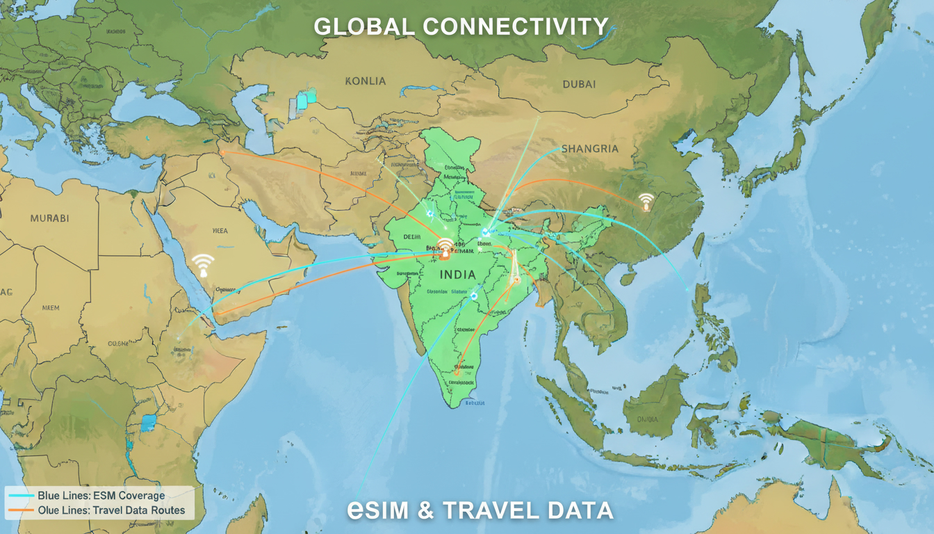
In short, what you'll discover in this article: Explore the comprehensive map of India and Asia to understand India's geographical position, political borders, physical features, and demographic distribution within Asia. Gain access to thematic maps, interactive resources, and practical comparisons for educational and professional use.
1. Introduction
Understanding the map of India and Asia is essential for grasping how India fits within the vast Asian continent. This article aims to provide a detailed overview of India's location relative to its neighboring countries, major geographical features, and political boundaries.
Whether you are preparing a presentation or seeking clarity on regional connectivity, a clear map helps visualize India's strategic position in Asia.
2. Geographical Overview
2.1 Position of India Within Asia
India is situated in South Asia, forming a significant part of the Asian continent's southern region. It shares borders with Pakistan to the northwest, China and Nepal to the north, Bhutan to the northeast, and Bangladesh and Myanmar to the east.
The Indian Ocean lies to its south, providing extensive coastline access.
This positioning places India as a bridge between Central Asia, Southeast Asia, and the Middle East, influencing trade routes and cultural exchanges.
2.2 Annotated General Map (Borders, Neighboring Countries, Seas, Mountains)
A detailed map of India and Asia highlights:
- Borders: Clear demarcations between India and its neighboring countries.
- Neighboring Countries: Pakistan, China, Nepal, Bhutan, Bangladesh, Myanmar.
- Seas: Arabian Sea to the west, Bay of Bengal to the east.
- Mountain Ranges: The Himalayas form India's northern boundary.
- Major Cities: New Delhi (capital), Mumbai, Kolkata, Chennai.
Such a map visually contextualizes India's scale relative to other Asian nations and natural landmarks.
3. Important Thematic Maps to Include
3.1 Relief and Physical Geography (Rivers, Mountains, Plains)
A physical map of India and Asia displays:
- The Himalayan mountain range.
- Major rivers like the Ganges, Brahmaputra, and Indus.
- Extensive plains such as the Indo-Gangetic Plain.
- Plateaus like the Deccan Plateau.
These features shape climate patterns and human settlement across the region.
3.2 Political Boundaries (Indian States and Asian Countries)
The political map of India and Asia shows:
- Indian states with their administrative borders.
- Asian countries with national boundaries.
- Capital cities marked for reference.
This map aids in understanding governance divisions within India and its geopolitical context in Asia.
3.3 Demographics (Population Density, Urban/Rural Distribution)
Demographic maps illustrate:
- Population density hotspots in northern India and coastal cities.
- Urban centers versus rural areas.
- Migration trends within Asia impacting economic hubs.
Such data supports analyses related to infrastructure planning or market research.
3.4 Economy (GDP Distribution, Key Industrial Zones)
Economic maps highlight:
- Regions contributing significantly to India's GDP like Maharashtra and Tamil Nadu.
- Industrial corridors connecting Indian cities with Asian markets.
- Trade routes across Asia influencing economic integration.
This helps visualize economic strengths within India compared to broader Asian regions.
3.5 Languages and Religions (Distribution Maps)
Cultural maps depict:
- Linguistic diversity across Indian states.
- Major religions practiced in India and neighboring countries.
These maps enrich understanding of social dynamics shaping regional identities.
4. Interactive Maps and Downloadable Resources
4.1 Interactive Versions: Features Offered (Zooming, Layers, Tooltips)
Interactive maps allow users to:
- Zoom into specific regions for detailed views.
- Toggle layers showing political borders, physical geography, or demographics.
- Access tooltips with additional information on cities or landmarks.
These features enhance user engagement for presentations or research.
4.2 Downloadable Formats and Usage Recommendations (SVG, PDF, PNG)
For offline use or printing:
- SVG files are ideal for scalable graphics without quality loss.
- PDF format suits high-resolution printouts.
- PNG images provide easy embedding in digital documents.
Choosing the right format depends on your project's needs.
4.3 Integration Tutorial for Websites and Responsive Optimization
Embedding maps on websites requires:
- Selecting interactive or static map formats compatible with your platform.
- Ensuring responsive design so maps display well on all devices.
- Optimizing load times by compressing images or using vector formats.
For detailed guidance on digital integration alongside eSIM connectivity options in India, see our complete guide on India eSIM activation.
5. Practical Comparisons and Analyses
5.1 Comparing Area and Population: India vs Asian Regions
India covers approximately 3.29 million square kilometers with over 1.4 billion people—making it one of Asia's largest countries by population but moderate in land area compared to Russia or China.
Understanding these figures helps contextualize India's demographic weight relative to other Asian nations.
5.2 Time Zones and Distances
India operates under a single time zone (Indian Standard Time - UTC+5:30), while Asia spans multiple zones from UTC+2 in western parts to UTC+12 in eastern regions.
Distances between Indian cities like Delhi or Mumbai to other Asian capitals affect travel planning and telecom connectivity—key considerations when choosing eSIM data plans for cross-border use (see how to get an eSIM in India).
6. Educational and Professional Uses
6.1 Exercises and Activities for Educators
Teachers can use thematic maps of India and Asia for:
- Geography quizzes highlighting country locations.
- Discussions on physical features influencing culture.
- Projects comparing economic zones across Asia.
These activities foster interactive learning experiences.
6.2 Use in Reports, Presentations, Market Studies
Professionals benefit from these maps by:
- Visualizing market penetration across Indian states within Asian contexts.
- Analyzing geopolitical risks based on border proximities.
- Enhancing presentations with clear visual aids showing India's role in Asia's economy.
For enhanced telecom connectivity insights during travels or business trips within these regions, consider exploring our main eSIM India page.
7. Technical and Legal Considerations
7.1 Data Sources and Cartographic Accuracy
Reliable maps derive from authoritative sources such as government surveys or global geographic databases ensuring accuracy in borders and features shown.
For example, political maps from World Atlas provide verified boundaries useful for educational purposes.
7.2 Licensing and Usage Rights of Maps
When using maps for presentations or publications:
- Verify licensing terms; many stock images require attribution or purchase.
- Prefer free-to-use or Creative Commons licensed maps when available.
Adobe Stock offers a variety of royalty-free images under clear usage terms (Asia Map India collection) suitable for professional projects.
8. Conclusion
A detailed map of India and Asia is invaluable for understanding India's geographical context within the continent’s vast diversity. Whether for education, professional reports, or personal projects like presentations on Asian geography, these maps clarify complex relationships between countries, physical landscapes, demographics, and economies.
To complement your geographic insights with seamless connectivity during travels across these regions, explore competitive eSIM data plans available through trusted providers featured on indiasim.com—helping you stay connected effortlessly from Delhi to Goa without roaming fees.
For further details on activating your eSIM while exploring India’s diverse regions shown on these maps, visit our comprehensive guide at India eSIM activation.
FAQ
Where is India located within the Asian continent?
India is situated in South Asia, bordered by Pakistan, China, Nepal, Bhutan, Bangladesh, and Myanmar. It lies south of the Himalayas and has extensive coastlines along the Arabian Sea and Bay of Bengal.
What major geographical features define India’s borders?
India’s northern border is defined by the Himalayan mountain range. It also has major rivers like the Ganges and Brahmaputra, and is flanked by seas to the west and east, shaping its natural boundaries.
How do political maps show India’s relation to Asia?
Political maps highlight India’s states with administrative borders and its neighboring Asian countries with national boundaries. Capitals and major cities are marked to provide clear geopolitical context.
What interactive features are available for maps of India and Asia?
Interactive maps offer zooming, layer toggling for borders or demographics, and tooltips with detailed info on cities or landmarks, enhancing user engagement for research or presentations.
How can maps of India and Asia support educational projects?
These maps help educators create geography quizzes, discuss physical features influencing culture, and compare economic zones. They provide visual aids that improve understanding of India’s role within Asia.

Anjali Rao
Anjali is a travel and technology writer who has criss-crossed India by train, plane and rickshaw. At India eSIM she tests travel data plans on Jio, Airtel and Vi and explains how visitors can stay online affordably from Delhi to the backwaters of Kerala.