India Map in Asia Showing Location and Regional Connections
7/28/2026
In short, what you'll discover in this article:
Explore the india map asia to understand India's exact location on the Asian continent. This guide offers clear visuals, types of maps, geopolitical insights, and interactive options perfect for your presentation or travel planning.
1. Quick Overview — Where Is India Located in Asia?
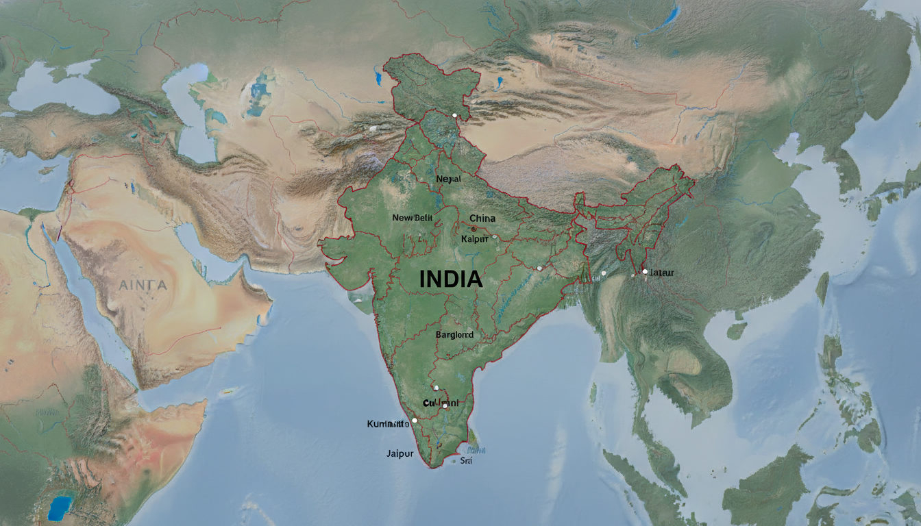
India is situated in South Asia, forming a significant part of the Indian subcontinent. It shares borders with several countries and has a vast coastline along the Indian Ocean.
Understanding the geographical location of India in Asia helps grasp its strategic importance and regional connectivity.
1.1 Geographical Position and Neighboring Countries
India lies south of the Himalayan mountain range, which separates it from East Asia. Its neighbors include Pakistan to the northwest, China and Nepal to the north, Bhutan to the northeast, and Bangladesh and Myanmar to the east.
The Arabian Sea borders India on the west, while the Bay of Bengal lies to the east.
This position places India as a central hub connecting South Asia with Southeast Asia and beyond. The country's diverse borders influence its cultural and economic interactions with surrounding nations.
1.2 Key Summary for Readers in a Hurry (Distance, Area, Coastline)
- India covers approximately 3.29 million square kilometers, making it the seventh-largest country globally.
- It has a coastline stretching about 7,517 kilometers.
- The distance from its northernmost point (Kashmir) to its southern tip (Kanyakumari) spans roughly 3,200 kilometers.
These figures highlight India's vastness and its critical maritime access on the Asian continent.
2. Types of Maps Available for India
To fully understand India's place in Asia, different map types serve various purposes—from political boundaries to physical terrain and thematic data.
2.1 Political Map (States and Borders)
A political map of India in Asia clearly delineates state boundaries within India as well as international borders with neighboring countries. This type of map is essential for understanding administrative divisions and geopolitical context.
For example, political maps often highlight disputed regions such as Jammu and Kashmir with special border markings to reflect ongoing territorial discussions.
2.2 Physical Map (Relief, Rivers, Mountains)
A physical map of India in Asia shows natural features like mountain ranges (e.g., the Himalayas), major rivers such as the Ganges and Brahmaputra, deserts like Thar, and plateaus including the Deccan. These maps help visualize India's diverse topography and natural landscape.
2.3 Thematic Maps (Population, Languages, Climate)
Thematic maps provide insights into specific aspects such as population density across states, linguistic distribution, or climate zones. These maps are useful for presentations that require demographic or environmental context alongside geographic location.
2.4 Historical Maps and Trade Routes
Historical maps reveal how India's borders have changed over time and illustrate ancient trade routes like the Silk Road or maritime paths connecting India with other Asian regions. These add depth to understanding India's evolving role on the continent.
3. Interactive Visualizations and Downloads
Modern tools allow users to interact with maps or download them in various formats suitable for presentations or digital projects.
3.1 Available Formats (SVG, PNG, KML, GeoJSON) and Usage Recommendations
- SVG: Scalable Vector Graphics ideal for high-quality prints or zoomable web maps without loss of resolution.
- PNG: Raster images suitable for quick use in documents or slides.
- KML/GeoJSON: Geographic data formats compatible with GIS software or Google Earth for advanced spatial analysis.
Choosing the right format depends on your project needs—SVG is best for clarity in presentations requiring zooming; PNG works well for simple visuals; KML/GeoJSON suits interactive mapping applications.
3.2 Integration (iframe, API, Sample Code) and Accessibility Best Practices
Embedding interactive maps via iframe or APIs enhances user engagement on websites or digital reports. Ensure accessibility by providing descriptive alt text like “Political map of India in Asia showing neighboring countries” for screen readers and optimizing loading times through compressed images or deferred loading techniques.
4. Map Projections and Accuracy
Map projections affect how India's shape and size appear relative to other Asian countries.
4.1 Common Projections and Their Impact on Representation
Popular projections include Mercator (distorts size near poles), Robinson (balances size and shape), and Lambert Conformal Conic (used for regional maps). Each influences how the position of India on the Asian continent is perceived visually.
4.2 Scale, Resolution, and Tips for Printing/Web Display
Higher resolution maps are necessary for print materials to avoid pixelation; web displays benefit from optimized file sizes for faster loading without sacrificing clarity. Always check scale bars on maps to understand distances accurately.
5. Borders and Geopolitical Issues
India's borders are complex due to historical conflicts and ongoing disputes.
5.1 Disputed Areas (e.g., Jammu & Kashmir) — Factual Presentation and Sources
The Jammu & Kashmir region remains contested between India, Pakistan, and China. Maps typically show these areas with dashed or dotted lines indicating disputed status based on international conventions.
For factual accuracy on these zones, refer to authoritative sources like government publications or WorldAtlas.
5.2 Indicating Conventions Used on Maps (How Borders Are Represented)
Maps clarify border status using color codes or line styles—solid lines for recognized borders; dashed lines for disputed boundaries—to inform viewers without bias.
6. Comparison: India vs Asian Regions
Understanding India's location also involves comparing it with other Asian subregions.
6.1 Contextual Maps (South Asia, Southeast Asia, Central Asia)
Maps highlighting South Asia show India alongside Pakistan, Bangladesh, Nepal, Bhutan, Sri Lanka, and Maldives. Southeast Asia includes countries like Thailand and Vietnam; Central Asia covers Kazakhstan and Uzbekistan.
This comparison illustrates India's pivotal role bridging multiple regions culturally and economically.
6.2 Geographic Impacts on Climate, Trade, and Demographics
India's diverse geography influences monsoon patterns vital for agriculture; its ports facilitate international trade; demographic trends vary widely across states due to geography-driven settlement patterns.
7. Data Sources and Licensing
Reliable data ensures map accuracy and legal use.
7.1 Source List (OpenStreetMap, Natural Earth, Government Agencies) & Update Dates
Common sources include OpenStreetMap for open geographic data; Natural Earth for global vector/raster maps; Indian government agencies provide official boundary data updated periodically.
7.2 Licensing Terms & Reuse Conditions
Most open data comes under licenses like ODbL allowing free use with attribution; commercial use may require permissions depending on source terms—always verify before redistribution.
8. Conclusion And Call To Action
This comprehensive guide on india map asia equips you with clear visuals and detailed context about India's location within Asia—perfect for presentations or travel planning projects. For enhanced connectivity during your travels across India’s vast regions shown here, consider exploring eSIM options tailored specifically for India at indiasim.com/blog/esim-in-india. Stay connected effortlessly from Delhi to Goa without roaming fees by comparing plans online at indiasim.com/blog/india-esim-online.
Embrace accurate mapping combined with seamless connectivity solutions today!
FAQ
Where is India located on the Asian continent?
India is located in South Asia, bordered by Pakistan, China, Nepal, Bhutan, Bangladesh, and Myanmar. It lies south of the Himalayas and has coastlines along the Arabian Sea and Bay of Bengal.
What types of maps show India’s geography in Asia?
Maps include political maps showing states and borders, physical maps highlighting mountains and rivers, thematic maps for population or climate, and historical maps illustrating trade routes and border changes.
How can I use interactive maps of India for presentations?
Interactive maps are available in formats like SVG, PNG, KML, and GeoJSON. They can be embedded via iframe or API to enhance engagement and are suitable for detailed spatial analysis or visual clarity.
What are the main disputed border areas involving India?
The Jammu & Kashmir region is a key disputed area involving India, Pakistan, and China. Maps represent these zones with dashed lines to indicate contested borders based on international standards.
How does India’s location affect its climate and trade?
India’s diverse geography influences monsoon patterns critical for agriculture and provides extensive ports facilitating international trade. Its position bridges South Asia with Southeast Asia, impacting demographics and economic connections.

Anjali Rao
Anjali is a travel and technology writer who has criss-crossed India by train, plane and rickshaw. At India eSIM she tests travel data plans on Jio, Airtel and Vi and explains how visitors can stay online affordably from Delhi to the backwaters of Kerala.